Trajectory LiDAR Data One Key Processing Software gAirHawk Point Cloud Self Developed Geosun
gAirHawk 4.9 version combines trajectory processing software (Shuttle)and lidar data processing software (gAirHawk) together.
Shuttle is a high-precision GNSS/INS positioning and attitude determination post-processing software, independently developed by Wuhan Geosun Navigation Technology Co., Ltd., built-in high precision GPS/GLONASS/Beidou II/Galileo positioning velocity measurement processor (GGPoS). The system can process multi-mode GNSS positioning velocity measurement, GNSS/INS combined positioning attitude measurement, providing centimeter-level spatial position information of motion point (or carrier), centimeter-level speed information, and thousand-degree attitude information.
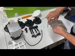
gAirHawk is a lidar scanning system acquisition monitoring and point cloud computing software self-developed by Geosun Navigation. It supports real-time configuration and monitoring of field data acquisition systems, decoding of real-time and post-process laser scanning data, calculation and display of point cloud data, supporting software for Geosun lidar scanning system.
Shuttle is a high-precision GNSS/INS positioning and attitude determination post-processing software, independently developed by Wuhan Geosun Navigation Technology Co., Ltd., built-in high precision GPS/GLONASS/Beidou II/Galileo positioning velocity measurement processor (GGPoS). The system can process multi-mode GNSS positioning velocity measurement, GNSS/INS combined positioning attitude measurement, providing centimeter-level spatial position information of motion point (or carrier), centimeter-level speed information, and thousand-degree attitude information.
gAirHawk is a lidar scanning system acquisition monitoring and point cloud computing software self-developed by Geosun Navigation. It supports real-time configuration and monitoring of field data acquisition systems, decoding of real-time and post-process laser scanning data, calculation and display of point cloud data, supporting software for Geosun lidar scanning system.
UAVLIDAR
LIDAR DATA
Trajectory
POS
POINTCLOUD
High Precision
Strip Adjustment
Opti
optimization
-

Sistema de escaneo LiDAR GAirHawk serie GS-1500N Mapeo VTOL aéreo de detección larga de 8 ecos
Contactar ahora -
Dron multirotor LiDAR para inspección, mapeo, topografía, seguridad
Contactar ahora -
Sistema LiDAR UAV de alta precisión con amplio campo de visión
Contactar ahora -
Largo alcance 1000M Altitud de vuelo 1 cm Precisión Móvil LiDAR Geosun GS-1350W
Contactar ahora -
Escaneo láser de largo alcance Vehículo UAV VTOL compatible con procesamiento de trayectoria libre de nube de puntos de cinco colores de eco
Contactar ahora
Videos relacionados